

Ownmates Post

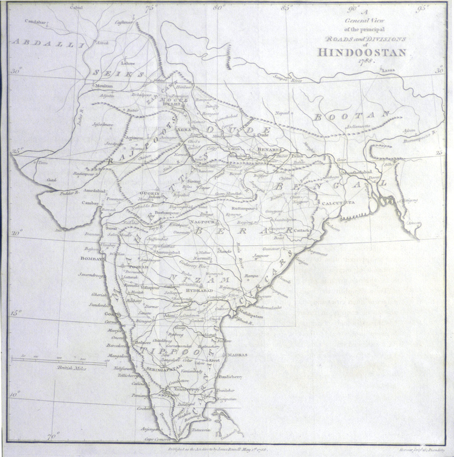
James Rennell, “A General View of the principle Roads and Divisions of Hindoostan,” from Memoir of a Map of Hindoostan or the Mogul Empire (London, 1788).
James Rennell, (1742 – 1830) was an English geographer, historian and a pioneer of Indian cartography.
Rennell’s survey of Bengal, which was commenced in the autumn of 1764, was the first ever prepared. The headquarters of the surveyor-general were at Dacca, and in the successive working seasons he gradually completed his difficult, laborious, and dangerous task.
He worked in Bengal and elsewhere for a period of 13 years, during which he surveyed an area of about 300,000 square miles, stretching from the eastern boundaries of Lower Bengal to Agra, and from the Himalayas to the borders of Bundelkhand and Chota Nagpur. Rennell was originally just one surveyor among many, but he showed such enthusiasm and ability that Major-General Robert Clive, the governor of Bengal and Bihar, promoted him to Surveyor-General in 1767. Rennell was only 24 at the time. The mapping project was originally a general survey of newly acquired lands, but the job soon gained a wider scope under Warren Hastings, who was appointed as Governor-General in 1773. One of Hastings’ first projects was to begin a detailed reckoning of property, land, people, and culture for taxation of revenue. As for Rennell’s part in this, his project was carried out much like a military survey, searching for safe passage through territory, with information gathering a secondary object.
In 1776, when on the frontier of Bhutan, his party was attacked by some Sannyasis (ascetic warriors), and Rennell himself was desperately wounded. He never entirely recovered from the effects of his injuries, and was thenceforth less able to withstand the effects of the climate. He received the rank of major of Bengal engineers on 5 April 1776, and retired from active service in 1777. The government of Warren Hastings granted him a pension of £600 per annum, which the East India Company somewhat tardily confirmed.
Rennell surveyed Bengal separately, during his work at India and sketched up the most detail geographical information ever has listed particularly in this area. For the sake of better understanding of his data he wrote a book titled “Memoir of a map of Hindoostan”. He categorized places into seven categories: Cities (2), Capital of Province (13), Large Town (51), Large Bazar and Cutcherry (255), Small Bazar and Cutcherry (577), Village (1974) and Fort (18).
The remaining fifty-three years of his life were spent in London, and were devoted to geographical research chiefly among the materials in the East India House. He took up his residence in Suffolk Street, where his house became a place of meeting for travellers from all parts of the world.


Comments
No comments yet.